Position
Master’s Capstone Project
Organizations
Wetzin’kwa Community Forest Corporation, Silvicon Services
The Wetzin’kwa Community Forest (WCF) is 33,000 hectare forest tenure co-managed by the Town of Smithers, the Town of Telkwa and the Wet’suwet’en Nation.
WCF contains a mix of harvestable timber stands, cultural heritage sites, and areas dedicated to recreational use. Its management is guided by five distinct values: Cultural, Economic, Ecological, Recreational, and Community.
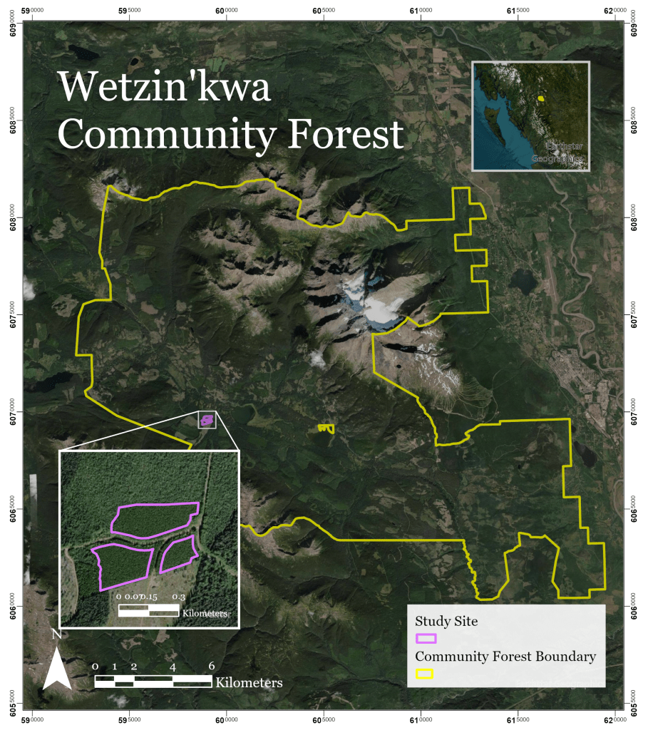
This project aims to use data-driven modelling to design a thinning prescription that enhances ecological resilience and stand structure while promoting cultural and community foraging access.
Thinning is a forest management practice that removes a portion of trees within a stand to reduce competition for light, water, and nutrients to improve the health and growth of the remaining trees. Historically, thinning has been driven primarily by economic objectives; however, it can also provide important co-benefits, including increased resilience to disease and wildfire, enhanced ecological diversity, and the promotion of understory forage plants for both wildlife and community use.
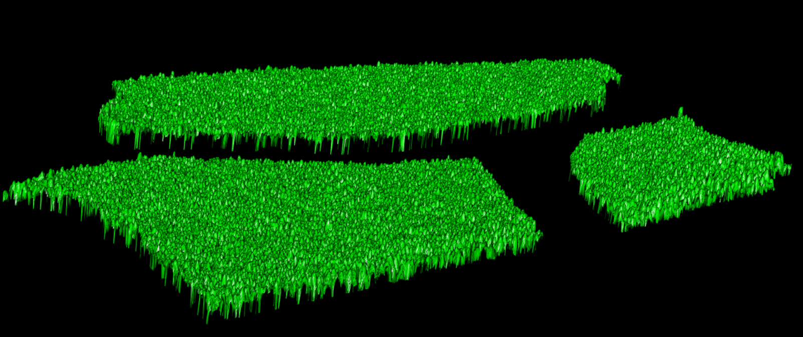
To design a precision thinning prescription, a model of the stand was developed using LiDAR point cloud data and plot-level field measurements.
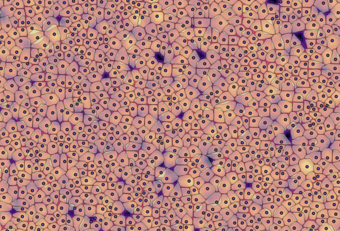
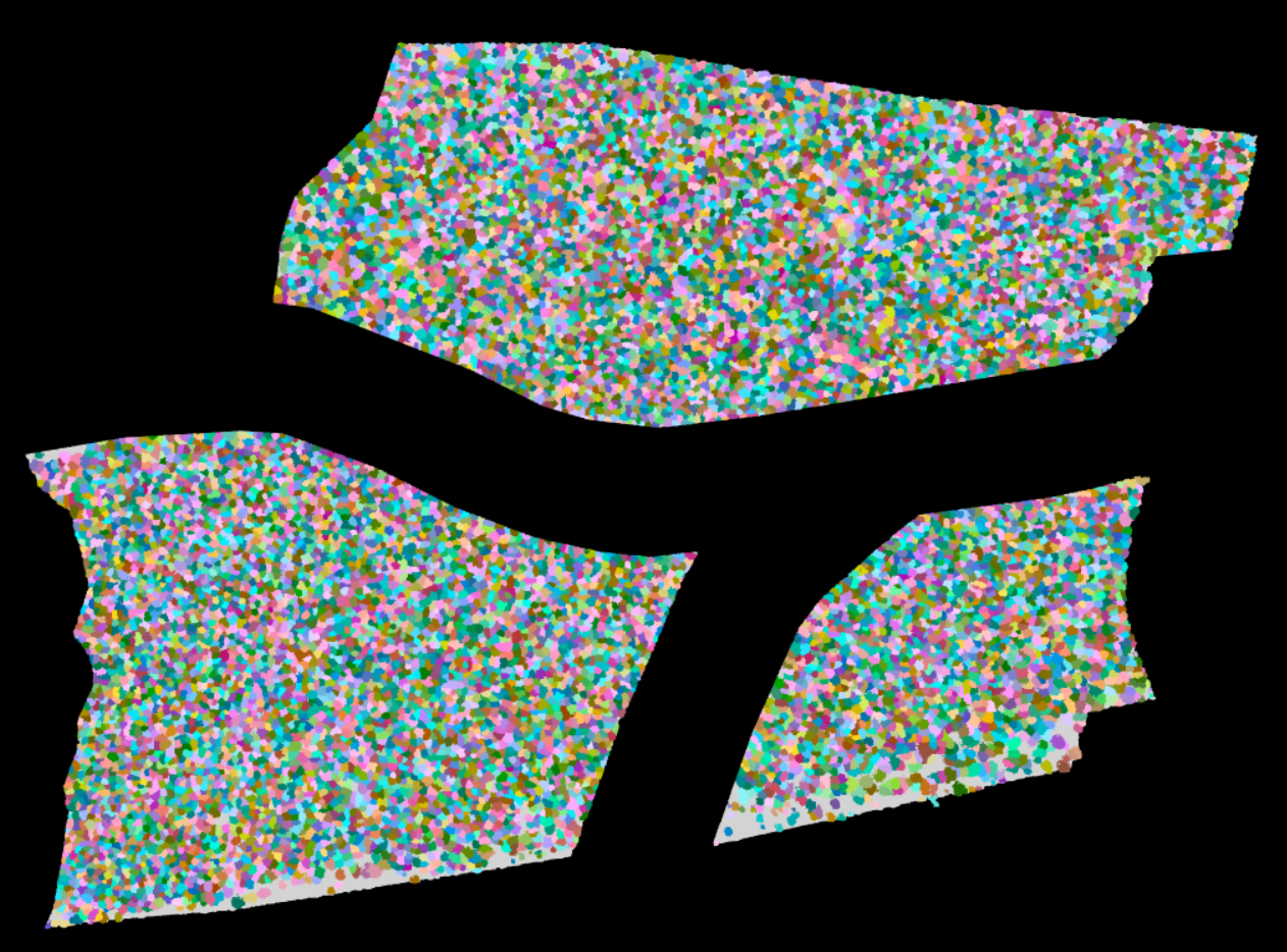
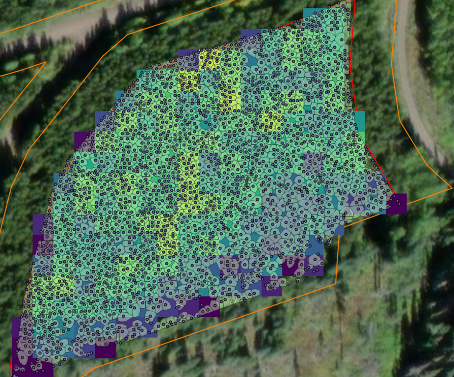
The LiDAR dataset was clipped to the project boundary and pre-processed to prepare it for analysis. Individual trees were then detected and segmented from the LiDAR-derived canopy height model using the lidR package in RStudio. This workflow produced a spatially explicit inventory of individual trees across the stand.
Plot-level field measurements were used to fit predictive models estimating tree attributes across the stand. These models generated stand-wide predictions of DBH, crown diameter, and basal area for each segmented tree, enabling detailed structural mapping at the individual-tree scale.
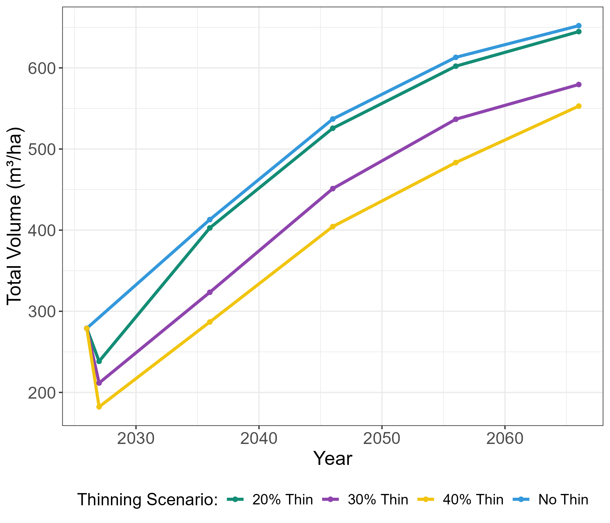
With a complete tree-level dataset established, thinning scenarios were modelled in the Forest Vegetation Simulator (FVS) to evaluate projected outcomes over time. Scenario comparisons included expected changes in mortality, tree growth, stand health, and merchantable volume.
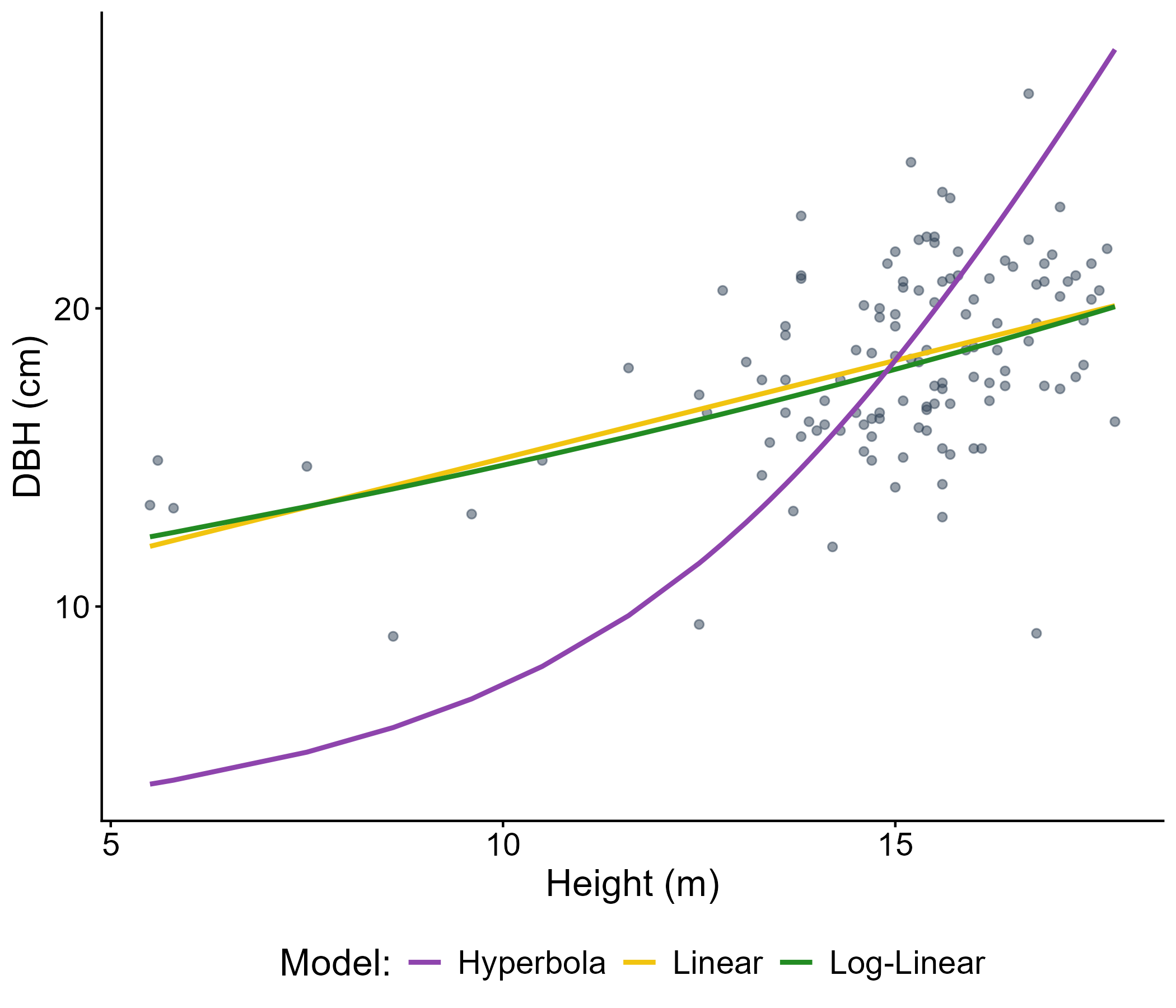
Comparison of three regression models fitted to plot-level data used to predict tree attuites across the stand.
Modelled stand volume (m³/ha) 40 years into the future under four growth scenarios.
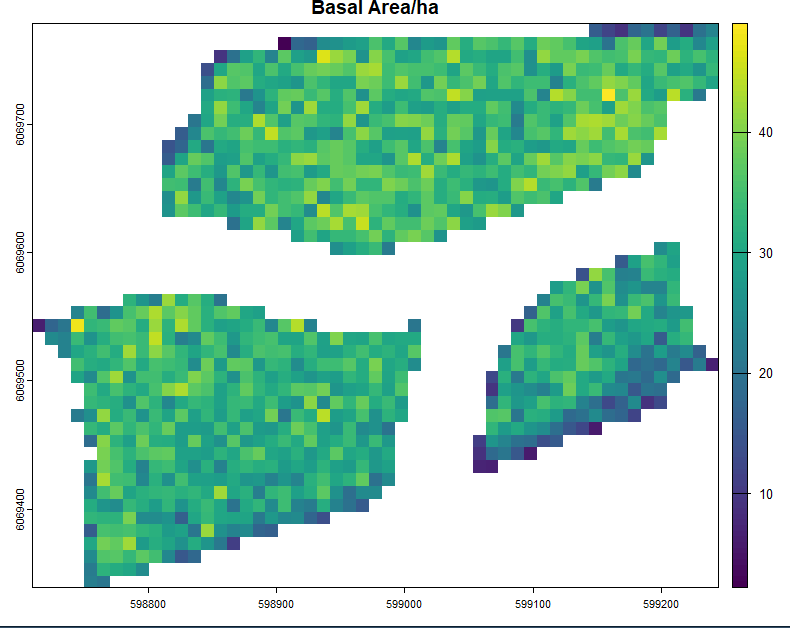
To support operational planning and spatial decision-making, stand conditions were summarized into 10 m × 10 m grid layers. These rasters included canopy cover, stems per hectare, and basal area, helping identify density patterns and structural variability that are difficult to interpret from tree-level outputs alone.
Thinning priorities were guided by ecological and cultural objectives, including enhancing existing huckleberry growth, increasing understory shrub growth, and enhancing habitat and forage availability for wildlife such as mule deer and moose. A targeted literature review informed recommended thinning intensity (% removal) and key implementation considerations.
These analyses were consolidated into a map in ArcGIS Pro, integrating scenario outputs, spatial metrics, and ecological priorities into a structured set of treatment recommendations (currently in progress).
